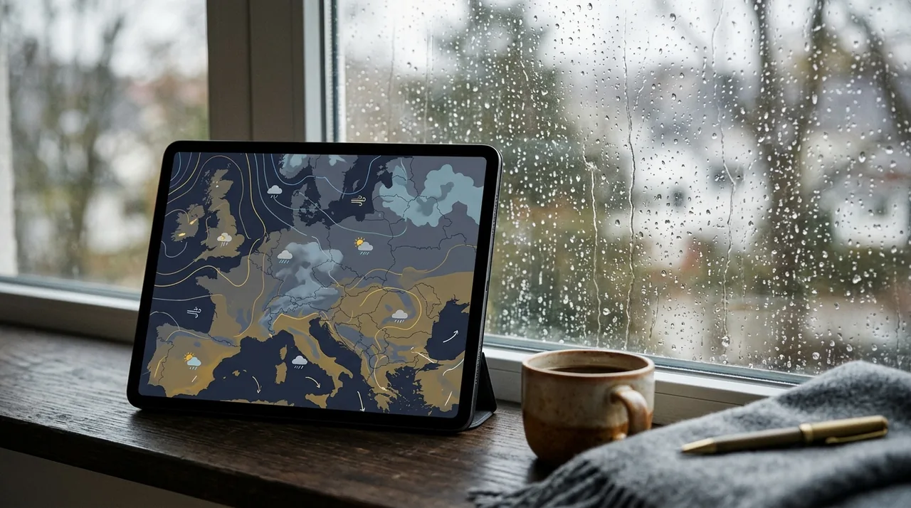
How can you read a weather forecast to plan your day better and avoid surprises? Learn the order of checking data, common mistakes, and practical interpretation examples.
What should you check first?
A good forecast reading starts with four elements: precipitation, wind, temperature, and alerts. These are the factors that most quickly affect comfort and safety. A sun icon or just the number next to the temperature is not enough, as it doesn't show the full picture.
- Start and end times of precipitation.
- Wind strength and direction, especially gusts.
- Perceived temperature, not just the one listed in the table.
- Meteorological warnings for the region.
Example: if you see 8°C and no rain in the morning, but the afternoon forecast shows precipitation and wind increasing to 40–50 km/h, you need to dress for the later hours, not just the morning. It's a small shift in thinking, but very practical.
How do you interpret an hourly forecast?
An hourly weather forecast shows short time intervals, making it best for planning a specific outing. Instead of looking only at the day's maximum temperature, check when rain is expected, whether the wind will pick up in the afternoon, and how long the cloud cover will last. This is especially
important for walks, running, commuting to work, and planning outdoor events.
The practical scheme is simple:
- Read the precipitation times and their expected duration.
- Check wind gusts, not just the average speed.
- Compare the temperature with the perceived temperature.
- Assess cloud cover during the hours that are crucial for you.
- Read meteorological warnings if any are active.
Example: at 9:00, it shows 10°C and no precipitation, but at 13:00, rain and stronger winds are expected. If you’re going out for a few hours, the weather at noon matters more than in the morning. This is exactly why an hourly forecast exists.
What do icons and precipitation percentages mean?
In many weather services, you see icons for sun, clouds, rain, or thunderstorms, along with a precipitation percentage. This percentage does not necessarily indicate the intensity of the rain or the duration of the precipitation. It most often indicates the probability of precipitation occurring at a specific place and time.
If you see a 40% chance of rain, it doesn't mean it will rain for 40% of the day. It means precipitation is possible but uncertain. That's why it's worth reading not just the icon but also the description: passing showers, local thunderstorms, light rain, moderate wind, strong gusts. Such a description provides more information than a single number.
- A sun icon doesn't always mean a cloudless sky.
- A cloud with rain icon doesn't specify whether the precipitation will be short or long.
- Precipitation percentage reflects probability, not the amount of rain.
- Perceived temperature accounts for wind and humidity.
Today's, 7-day, and 14-day forecasts — what are the differences?
Today's weather forecast forecast is usually the most practical because it covers a short timeframe and has higher accuracy. A 7-day forecast helps you see the trend: whether a cooling, warming, rainy period, or windy weather is approaching. A 14-day forecast, on the other hand, is indicative and should not be treated as a rigid plan.
The further out the date, the greater the uncertainty. This is normal because the atmosphere changes dynamically. Therefore, a 14-day forecast is useful more for general orientation, such as choosing a travel date, rather than for planning a specific meeting time. With fronts, thunderstorms, and local precipitation, differences between services are quite natural.
In risk communication, this is key: a forecast is meant to help with decisions, not to pretend to complete certainty. If you see several versions of a forecast, compare them calmly instead of picking one and treating it as absolute truth.
What mistakes do we make most often?
The most common mistake is focusing exclusively on the maximum temperature. The second is ignoring the wind, which can significantly lower thermal comfort, especially in open spaces. The third mistake is treating a 14-day forecast as a promise rather than an indicative trend.
Another problem is relying on just one source. It is better to compare several services, especially when planning something important. You can check the online forecast, IMGW communications, and precipitation maps. If all sources show a similar direction of change, the decision is more reliable.
The language of the forecast is also often misunderstood. When someone sees "passing showers," they assume it will rain all day. Meanwhile, this usually means short and local precipitation that may appear only part of the day. Such nuances really make a difference.
How to distinguish weather from climate?
Weather describes a short-term state of the atmosphere: today's rain, tomorrow's wind, or an evening thunderstorm. Climate refers to average conditions over a longer period, usually counted in years. One cold day doesn't change the climate, just as one warm week doesn't invalidate winter.
This distinction helps to avoid hasty conclusions. Just because it rains and is cold for a few days doesn’t mean the entire season will be the same. A forecast is intended for planning the next hours and days, while climate describes long-term trends.
How can I check meteorological warnings?
Meteorological warnings hold more significance than just an icon in an app, as they indicate real risks. They may pertain to strong winds, thunderstorms, heavy rainfall, icing, heatwaves, or freezing precipitation. If a warning is active, it’s wise to consider it a prompt to adjust your plans.
rather than a mere curiosity.
Before you head out, check if the alert applies to your region and what specific hazard it addresses. For drivers, visibility, crosswinds, and slippery road conditions are crucial. For pedestrians, factors like gusts, puddles, icing, and potential rapid changes in conditions are key. This quick review can save you a lot of trouble.
If you are planning a longer trip, it’s better to check warnings before you depart than to rely on the situation "improving on its own." In terms of weather, rapid changes are common, making the timeliness of data very important.
How can I use an online forecast without chaos?
Online weather forecasts that don't require login are convenient because they let you check conditions quickly without creating an account. To avoid becoming overwhelmed with excessive data, maintain a simple order: start with today’s forecast, then look at the next few hours, and finally consider the upcoming days and warnings.
This method helps:
- Open today’s forecast.
- Check the morning, noon, and evening forecasts in the hourly breakdown.
- Compare the 7-day and 14-day forecasts only as trends.
- Read weather warnings for your region.
- If you have important plans, check for updates from an official source.
This structure helps reduce confusion and enables you to focus on what truly matters. Instead of simply asking, "Will it be warm?" it’s better to ask: "When will it rain, will it be windy, and are there any alerts?" This is much simpler and far more useful.
What does this look like in practice? Here are two examples:
First example: you are planning a walk after work. In the morning, the forecast shows sunshine, but rain and winds increasing to 35 km/h are expected after 5 PM. In this case, it would be better to leave earlier or shorten your route. The morning icon alone isn’t sufficient if the weather changes in the afternoon.
Second example: you are driving for the weekend. The daily summary seems calm, but a warning indicates strong winds and possible thunderstorms along your route. In that scenario, real-time road conditions and updates are more crucial than the temperature. This illustrates that effective forecast interpretation involves capturing the entire picture, not just one number.
If you want more practical tips, check the blog articles, where you’ll find additional advice on utilizing forecasts and alerts in daily life.
FAQ
How can I start reading a weather forecast simply?
Begin with the times of precipitation, wind strength, and warnings for your area. Temperature is significant, but it alone doesn’t provide the complete picture.
Is a 7-day weather forecast reliable?
While it can serve as a trend, it is less accurate than the forecast for today. The further out the date, the greater the uncertainty, especially concerning thunderstorms and fronts.
Why do two apps give different results?
Different services may utilize varying models, update frequencies, and methods of presenting data. Minor differences are completely normal.
Is a forecast without login less accurate?
Not necessarily. The data source and its timeliness are more important than whether the service requires an account.
This content is for educational purposes and does not replace notifications from meteorological services or local safety alerts. In dynamic weather situations, always check for current warnings from an official source.
Sources
World Meteorological Organization, Weather forecasting and warning services, 2023
National Weather Service, Forecast discussion and forecast uncertainty, 2024
Met Office, Understanding weather forecasts, 2023
European Centre for Medium-Range Weather Forecasts, Forecast ranges and uncertainty, 2024
IMGW-PIB, Meteorological warnings and forecasts, 2024
Sources
- World Meteorological Organization, Weather forecasting and warning services, 2023.
- National Weather Service, Forecast discussion and forecast uncertainty, 2024.
- Met Office, Understanding weather forecasts, 2023.
- European Centre for Medium-Range Weather Forecasts, Forecast ranges and uncertainty, 2024.
- IMGW-PIB, Meteorological warnings and forecasts, 2024.